Construction monitoring from orbit — every site, one screen
Construction monitoring is how teams verify what is actually happening on a site — and satellite construction monitoring lets you do it without driving out to each one. PropOrbit tracks construction site monitoring from groundworks to completion, turning each satellite pass into construction progress monitoring, satellite construction progress monitoring and construction progress tracking you can share with clients and lenders.
On large projects the gap between a progress report and reality is expensive, because construction financing is released against milestones that are usually self-reported. Independent overhead imagery gives every stakeholder the same verifiable view, making construction progress verification and construction site verification objective rather than a negotiation.
What construction teams use it for
Progress and milestones
Remote construction monitoring and remote construction site monitoring confirm milestones week over week, with construction progress assessment and construction progress reporting built on time-stamped evidence.
Change and delay
Construction change detection and construction site change detection surface what moved on site, so construction delay detection flags slippage before it hits your schedule and margin.
Documentation
Satellite imagery for construction and construction site satellite imagery create an objective record for lenders, insurers and owners — construction project monitoring and construction activity monitoring without site visits.

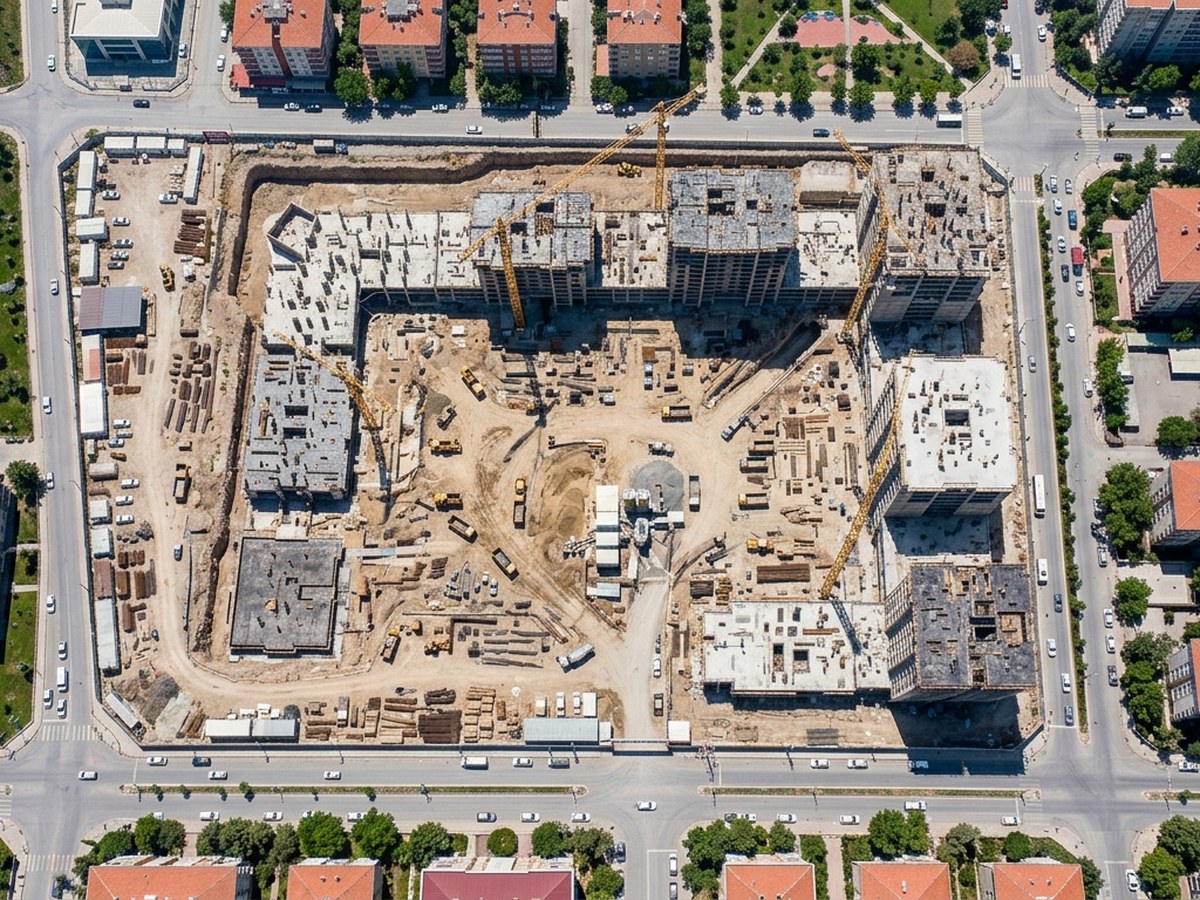
Monitor construction anywhere
From one project to a national program, PropOrbit delivers construction monitoring without site visits in under a minute per site. See it across Texas, Florida and every priority market in the USA.
From construction site intelligence to construction development monitoring, PropOrbit adds construction project tracking backed by time-stamped construction progress satellite imagery.
Frequently asked questions
What is construction monitoring?
Construction monitoring tracks a site's progress and change over time. Satellite construction monitoring does it from orbit, without a site visit.
Can construction progress be monitored remotely?
Yes — PropOrbit verifies milestones and detects change week over week from satellite imagery, giving lenders and owners an objective, time-stamped record.
How does satellite construction monitoring work?
Overhead imagery is captured on a schedule and compared over time to measure progress and flag delay before it affects the schedule.